Weathering, or rock decay, and erosion, or the
transportation of decayed rock, like most places, are integral to shaping
Norway’s physical geography—especially the narrow and steep fjords and “v”
shaped valleys, which were carved deeper than sea level by glacial weathering
and fluvial downcutting.
 |
| Fjord Counties of Norway |
 |
Jostedalsbreen
Glacier in Sogn og Fjordane Fjord county
|
 |
| More og Romsdal Fjord county |
 |
| Sogn og Fjordane Fjord county |
 |
| Rogaland Fjord County |
 |
| Hordaland Fjord county |
While chemical rock decay contributes to the breaking down of Norway’s landscape, primarily, weathering throughout Norway is due to mechanical or physical weathering, which is largely contributed to frost decay, high altitudes, and freeze-thaw cycles where water seeps into the joints or cracks, freezes, and expands causing translation slides, rock falls, avalanches, and earth flows.

On a side note, some of the biggest landslides have occurred
off the coast of Norway, known as the Storegga Slides, which were coastal
shelves the volume equivalence of Iceland that collapsed underwater, unleashing
a massive tsunami in the Norwegian Sea and North Atlantic Ocean.
 |
| Red numbers indicate height of tsunami |
Additionally, root pressure from vegetation contributes to the
decay of Norway’s landscape, and most of Norway’s fjords, valleys, and mountain
bases are transport limited with lush foliage and flora.

However, while much of Norway’s landscape is
vegetated and weathers because of frost decay, glacial weathering, and root
pressure, there are plenty of pressure release spots that can be found with
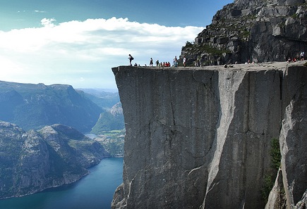
little or no vegetation, like famous Pulpit Rock.

Fluvial downcutting predating the last glaciation further
contributed to the breaking down, or creating, of Norway’s fjords, which
geomorphologists concluded due to the lack debris at the bottom of the fjords,
indicating much of the calluvium that originally fell from Norway’s slopes
became alluvium as it was transported by water.

While there is vegetation throughout Norway, much of Norway’s soil is infertile, deals with leaching, and
is difficult to grow with agriculturally. Because of cold, with some mild
summers, temperatures and increasing precipitation due to snow and glaciers, soil
goes through the gleization process where oxygen is depleted and organic
material accumulates as peat. In the melting periods between ice ages, much of
Norway was flooded with seawater due to the enormous weight of ice. Layers
of silt, clay, and sand were deposited along the coast and near Oslo.
References:
Nesje, A. “What is a fjord and how it is formed.”
Fjords.com. Department of Geography and Geology, University of Bergen. 2013.
Nesje, A., Dahl, S.O. Quatuernary
erosion in the Sognefjord drainage basin, Western Norway. Fjords.com/sognefjord.
Department of Geography, University of Bergen. 2013.
Nesje, A., Whillans, I. Erosion
of Sognefjord, Norway. Home.hisf.no. Department of Geography, University of
Bergen. Geomorphology, 9 (1994) 33-45.
James, L. ed. Illustrated
Encyclopedia of the Earth. Dorling Kindersley, Londond. 2003.
Environment and Heritage Service. Drainage Basin of the North Sea and Eastern Atlantic. United
Kingdom. Nd.
