Lithospheric plate tectonics and diastrophism have shaped
and continue to shape Norway and its physical geography. Norway is a part of
the Eurasian Plate, and
drifts northwesterly at a rate of 2cm/year. As a result of divergent plate
boundaries, volcanism, and sea-floor spreading in the Norwegian-Greenland Sea,
Greenland broke away from Norway. Major division took place along eastern
Greenland and northern Norway, and landmasses like the Voring and More
Plateaus became submerged by water, now known as the Norwegian Sea, which is
linked to the North Atlantic and North seas.

In depth reconstruction and mapping of faults and Greenland's separation from Norway HERE.
Because of Lithospheric plate movements and ever-changing
geography, theoretically, over the next 50 million years, Oslo will drift roughly
1,100km to the northeast and will be at the same latitude that Mid-Norway is today.
---

Norway’s mountains represent compression, folding,
anticlines, and convergent plate boundaries—especially the Scandinavian Peninsula,
which formed about 400 million years ago, due to continental subduction, and
covers Sweden, Norway, and most of northern Finland.

The peninsula was a part of the Caledonian Orogeney and emerged when the continents of Laurentia, Baltica, and Avalonia converged
and tectonic rifts between the Eurasian and North American plates occurred, closing the
North Iapetus Ocean and contributing to the formation of Pangea.
The western slope, facing Norway, drops into the North and Norwegian Seas, forming Norway’s fjords and to the north, bordering between Norway and Sweden.

Alfred Wegener geographically matched the Caledonian
Mountains in Norway and Sweden with the Canadian Appalachians. Today, the
Scandinavian Mountains are historically and geographically connected with the
mountains of Scotland and Ireland, along with the Appalachians of North
America.
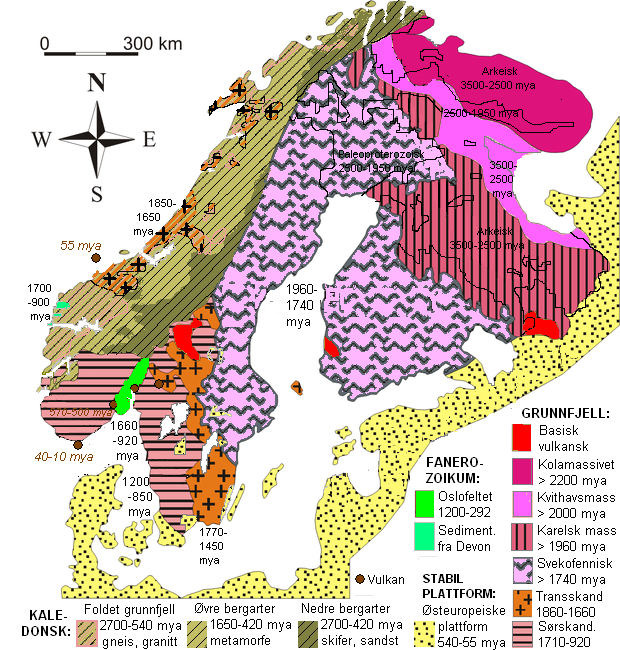
Primarily, the peninsula is made up of metamorphic rock.

Map of Norway's geology
---
Additionally, throughout Norway’s vast geographical
landscape, there are numerous sections of horsts and grabens. The most well
known graben is known as the Oslo Rift, which began to form during the Permian
era due to volcanism and tectonic uplift.


---
While there isn’t a lot of recent volcanic action in Norway,
on Jan Mayen, lies
Beerenberg—an extrusive, active stratovolcano, and the world’s northernmost
subaerial volcano.


Beerenberg’s most recent eruption was in 1985, with five
previously recorded, all of which were explosive.


More on Beerenberg:
---
Sources:
Brekke, H. (2000). The
tectonic evolution of the Norwegian Sea Continental Margin with emphasis on the
Voring and More Basins. Geological
Society. 167. 327-378. Web. Retrieved from Geological Society of London,
Special Publications 24 Jan. 2013.
Eldrett, J.S. and Harding,
I.C. Palynological analyses of Eocene to Oligocene sediments from DSDP Site
338, Outer VA ring Plateau: Reconstructing The Environment Of The Voring
Plateau. Marine Micropaleontology.
73. 226-240. Retreived from Geological Society of London, Special Publications.
Highline Community College.
(2009, November 18). Plate Tectonics. Dept.
of Physical Sciences. Retrieved from http://people.highline.edu/iglozman/classes/pscinotes/platetectonics.htm
Jones, K. and Blake, S.
(2003). Mountain Building in Scotland. Open
University Worldwide.
European Volcanological
Society. (2013). Mission Beerenberg, Jan Mayen Island. European Volcanological Society. Web. 29 Jan. 2013. Retrieved from http://www.sveurop.org/gb/menu/fr_menu.htm
Matte, P. (2001). The Variscan
caollage and orogeny (480-290 Ma) and the tectonic definition of the Armorica
microplate: a review. Terra Nova, 13,
122-128. Print.
Mosar, J., Torsvik. Opening the Norwegian and Greenland Seas: Plate tectonics in Mid Norway since the Late Permian. BATLAS. nd. Web. 3 February 2013. Retrieved from http://www.geodynamics.no/guest/BAT_Mosar_Torsvik.pdf.
Ramberg, I. B., Bryhni, I.,
Nottvedt, A. and Rangnes, K. (Eds.). The Making of Land: Geology of Norway. Trondheim. Norsk Geolgoisk Forening, 588-590. 2008. Print.
Wikipedia Commons
Image Sources:
http://www.sciencedirect.com/science/article/pii/S0921818107000719
http://www.lunduniversity.lu.se/o.o.i.s?id=24890&news_item=4763
http://matsolsson.net/Bergvandring/Berg/2011%20aug%20Norge/Galdhopiggen%2013%20aug/engGaldhopiggen.html
http://www.westcoastpeaks.com/Peaks/galdhopiggen.html
http://volcano.oregonstate.edu/beerenberg
http://www.volcano.si.edu/world/volcano.cfm?vnum=1706-01
http://www.geodynamics.no/guest/BAT_Mosar_Torsvik.pdf
http://www.geodynamics.no/guest/BAT_Mosar_Torsvik.pdf
Geographical Norway, Jackets, Men, Spring/Summer - LOVINABRAND
ReplyDeleteGeographical Norway. Comfort, quality, warmth and resistance are the hallmarks of our brand. Get deals on Jackets, Men, Spring/Summer and much more.